A Coastal Storm with Long Reach
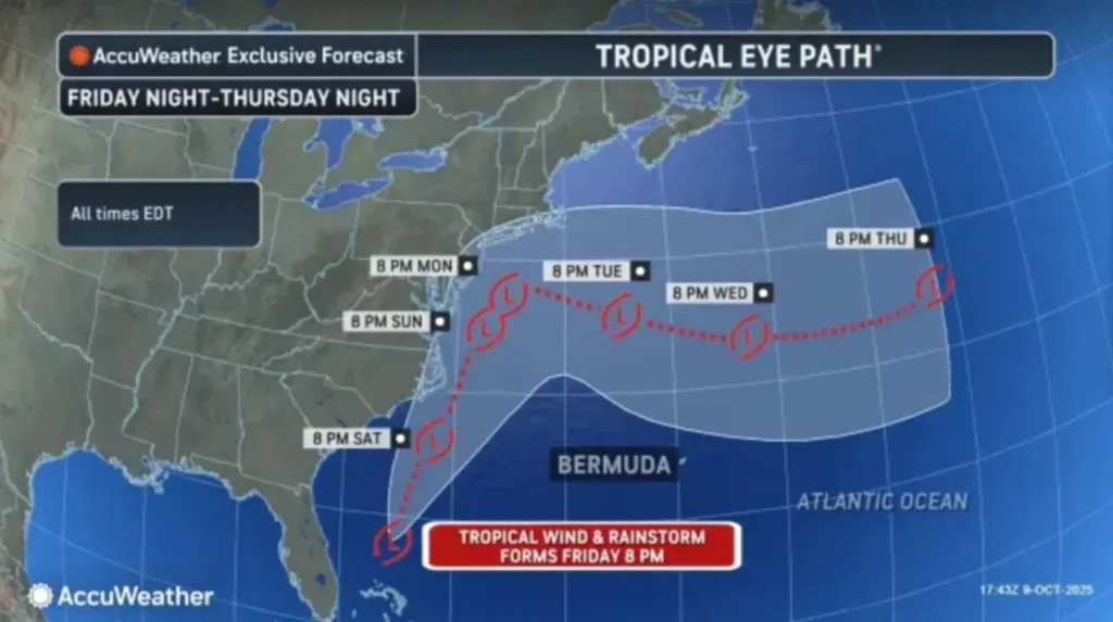
A slow-moving nor’easter is expected to batter the Jersey Shore beginning late Friday, with the National Weather Service (NWS) warning of “major coastal flooding, heavy surf, and sustained winds up to 60 mph.” The system is projected to stall just offshore, creating several tidal cycles of dangerous conditions that could last through Monday.
Meteorologists say the storm’s prolonged duration will be its most damaging feature. “This isn’t a quick hit,” the NWS office in Mount Holly cautioned Friday morning. “We’re looking at multiple high tide cycles of moderate to major flooding along the coast, with significant beach erosion likely.”
For Monmouth County, the combination of high winds and heavy rainfall poses a dual threat: flooding near bays and inlets, and uprooting risks for trees in saturated ground. The storm’s slow pace will mean relentless pounding on shorelines and soaked soil inland — a recipe for fallen limbs and power interruptions.
What Middletown Residents Can Expect
Forecasters expect 2 to 4 inches of rain, with locally higher amounts possible where the system’s rain bands stall. Winds are forecast to increase steadily overnight Friday, with gusts up to 60 mph along the coast and 40–50 mph inland through Saturday afternoon.
That means homeowners across Middletown should prepare for scattered outages, fallen branches, and road debris. The National Oceanic and Atmospheric Administration (NOAA) issued a statement emphasizing the potential for “widespread minor to locally major coastal flooding” during high tide cycles this weekend.
By Saturday morning, residents can expect road closures in low-lying coastal areas, particularly near the Navesink and Shrewsbury Rivers and throughout the Sandy Hook Bay region. Emergency management officials have also warned of “life-threatening surf and rip currents” and urge residents to stay off the beaches.
“This storm has the potential to cause repeated rounds of coastal flooding over several tide cycles,” the NWS advisory said. “Residents in flood-prone areas should prepare now for road closures and property flooding.”
Middletown's #1 Tree Expert Company
FREE Inspection & Estimate | Certified Arborists | Trimming, Pruning, Removal, More!
Sponsored
Winds That Can Topple Trees
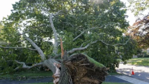
Strong easterly winds, gusting near 60 mph at the shoreline, will create dangerous conditions for trees already stressed by recent rainfall and lingering summer drought. Saturated roots lose their grip in heavy soil, making mature trees more likely to lean or fall when wind speeds surge.
Wind direction is also a key factor. With sustained gusts coming from the east and northeast, trees that typically grow with prevailing westward winds may be more vulnerable than usual. Limbs overhanging roads or power lines could snap under pressure, and large evergreens — such as pines and spruces — tend to act like sails during coastal storms.
“Winds of this strength can easily bring down small trees, large branches, and power lines,” NOAA’s coastal hazard outlook noted. “Residents should secure outdoor items and avoid parking vehicles under or near trees.”
Flooding Risks Stretch Beyond the Shore
While most headlines focus on beachfront damage, inland Middletown areas could also face flooding from backed-up storm drains and rising creeks. Prolonged rainfall and multiple high tide cycles can overwhelm local drainage systems, especially in neighborhoods with compacted soil or limited runoff capacity.
Forecasters say even areas that don’t usually flood could see standing water by Sunday morning. “The ground is already wet, and tides are running high,” the NWS said. “With this nor’easter, the concern isn’t just wind — it’s the persistence of heavy rain combined with tidal surge.”
Residents are urged to move vehicles to higher ground, clear gutters, and secure any yard items that could wash into storm drains. Local emergency officials recommend keeping a flashlight, charged phone, and backup battery on hand in case of extended power loss.
After the Storm: Tree and Property Safety
Once the nor’easter passes, the cleanup phase can be just as risky as the storm itself. Downed limbs, dangling branches, and partially uprooted trees may remain unstable even in calm weather. Property owners should approach cleanup with caution, as saturated soil can cause trees to shift days after a storm.
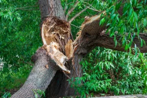
If a tree appears to have cracked limbs, exposed roots, or a visible lean that wasn’t there before, it may require professional inspection. High winds can cause hidden structural damage that isn’t immediately visible.
Officials also warn against touching or attempting to move any tree tangled with power lines. “Assume all downed wires are live,” the NWS advised. “Contact your local utility and stay at least 30 feet away.”
Homeowners across Monmouth County should expect cleanup crews to be active early next week, as debris removal and safety checks begin once conditions improve. Patience will be important — with ongoing flooding and possible tidal resurgence, some areas may remain inaccessible through Monday.
Middletown's #1 Tree Expert Company
FREE Inspection & Estimate | Certified Arborists | Trimming, Pruning, Removal, More!
Sponsored
Preparation Tips Before the Peak
-
Charge electronics and keep extra batteries ready for flashlights and radios.
-
Clear drains and gutters before the heaviest rain arrives.
-
Secure trash bins, furniture, and lawn equipment that could blow away in strong winds.
-
Move vehicles away from low-lying areas or under large trees.
-
Stay informed with local alerts from the NWS and Monmouth County Office of Emergency Management.
Even after the storm moves out, winds may remain gusty through early Tuesday, and additional rain bands could rotate inland. Meteorologists emphasize that nor’easters of this type often have a long tail, keeping the region unsettled for days.
A Storm That Tests Coastal Resilience
Nor’easters are nothing new to the Jersey Shore, but each one brings a reminder of how dynamic the coastline truly is. The persistent wind, flooding, and erosion events these storms cause can reshape dunes, undermine trees, and weaken root systems.
This weekend’s storm is a test of both preparation and patience for residents across Monmouth County. With the right precautions — from clearing drains to staying indoors during peak winds — the community can weather another round of coastal challenges.
As the NWS summed it up Friday afternoon: “This is a long-duration coastal storm. Prepare now and stay alert for changing conditions.”
